Arc3D
Personal projects | | Links:
Overview
Type : School
Technology : Unity, C#, Java
Project
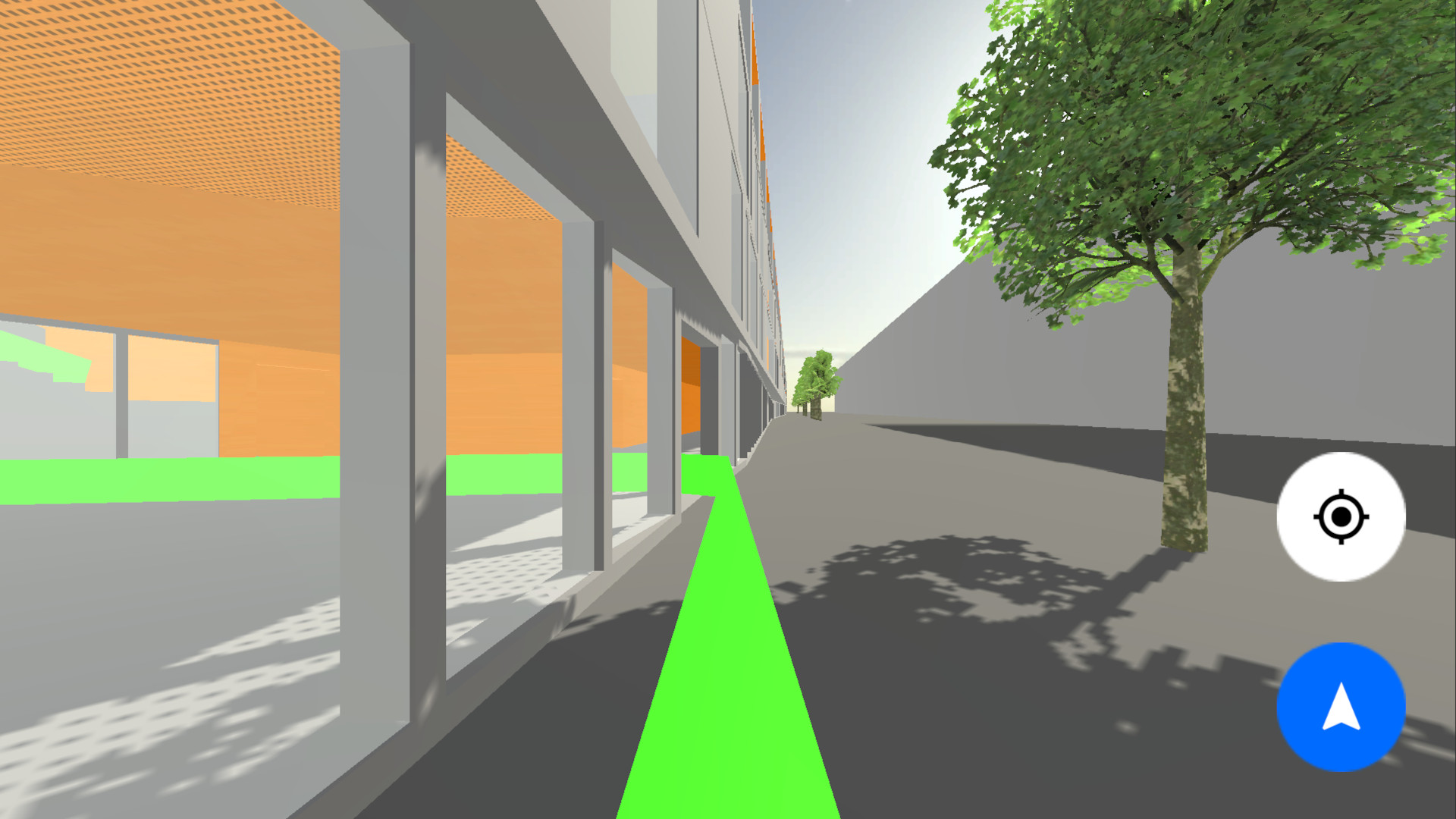
As part of a semester project, our objective was to develop an application enabling users to visualize the construction of the HE-Arc building and its surroundings through their smartphones. This application not only facilitates exploration for visitors and students but also incorporates guidance functionality akin to GPS, assisting in navigating from one point to another within the building. Additionally, it integrates an indoor geolocation feature.
For the guidance aspect, we utilized Unity’s pathfinding. Each room in the building is assigned a unique identifier and spatial coordinates within the scene. When a user selects a destination, this information guides the pathfinding agent toward the specified location.
Initially, we aimed to achieve localization through Wi-Fi Point Access and triangulation to enhance accuracy within the building environment compared to GPS. However, this approach proved unfeasible due to highly unstable transmitted signals and inadequate positioning of Access Points (APs) for proper triangulation. Consequently, we opted to rely on the GPS system instead.